06 Jun Clyde North Bushfire Hazard Management Plan
Nature Advisory (formerly Brett Lane & Associates) was engaged by a property developer to address a standard bushfire risk permit condition required under Melbourne’s Precinct Structure Plans (PSP), in relation to a large greenfield residential property development on Bells Road, Clyde North.
What is involved
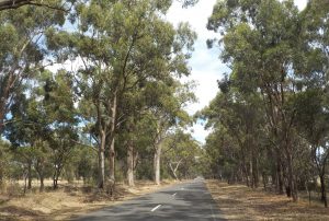
The property is located within Victoria’s Designated Bushfire Prone Area and, as such, planning approval requires preparation of a Bushfire Hazard Management Plan to meet the requirements of Clause 13.02 (Bushfire) and Clause 53.02 (Bushfire Planning) in the State Planning Provisions. The intention of a Bushfire Hazard Management Plan is to develop wildfire mitigation measures to safeguard construction workers and early residents in new settlements from exposure to potential wildfires in the surrounding landscape.
To address the requirements of the standard bushfire risk permit (under Melbourne’s PSPs), Nature Advisory first undertook a bushfire hazard site assessment of bushfire hazards within 150 metres of the property boundary in accordance with the Australian Standard AS 3959-2009 (construction of buildings in bushfire-prone areas). This assessment includes calculation of the bushfire attack level (BAL) associated with these bushfire hazards, which provides the calculation of the defendable space and construction requirements for the edges of the development facing bushfire hazards. A desktop analysis of bushfire hazards beyond 150 metres from the property boundary, of up to 75 kilometres (a landscape assessment), was then undertaken to predict potential fire runs from further abroad, based on extent and connectivity of bushfire hazards in the wider landscape and bushfire history.
Outcome
Based on the results of the site and landscape assessments, a Bushfire Hazard Management Plan was developed which prescribes bushfire management measures for the planning phase of the subdivision, based on the recommendations and publications of the relevant authority (the Country Fire Authority in Victoria) as reflected in other parts of the planning scheme in relation to bushfire risk mitigation. This facilitated the development of prescribed interim bushfire protection measures for the subdivision to mitigate any potential risks from undeveloped land remaining around the subdivision for any period.
Contact Chris Dunk for more information on our services for bushfire management